Black Swan Habitat
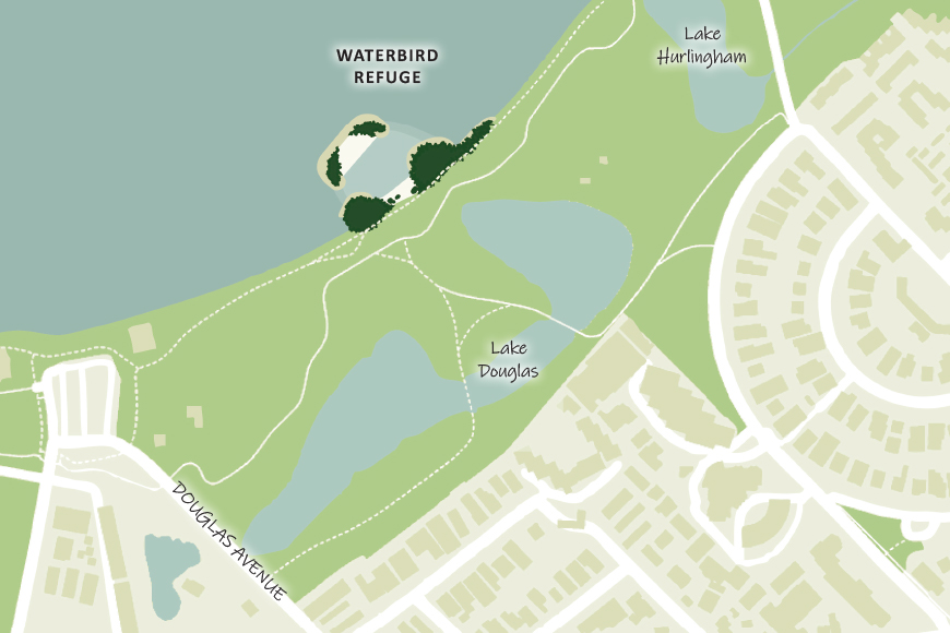
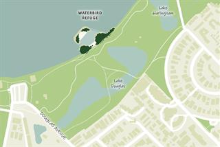
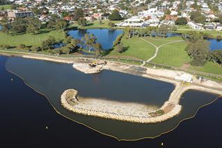
The Black Swan Habitat (formerly the Waterbird Refuge) project is located at Node 7: The Lakes area of South Perth Foreshore that sits east of Coode Street. This area contains a series of interconnected man-made lakes – Hurlingham Lake, Douglas Lake and Lake Tondut.
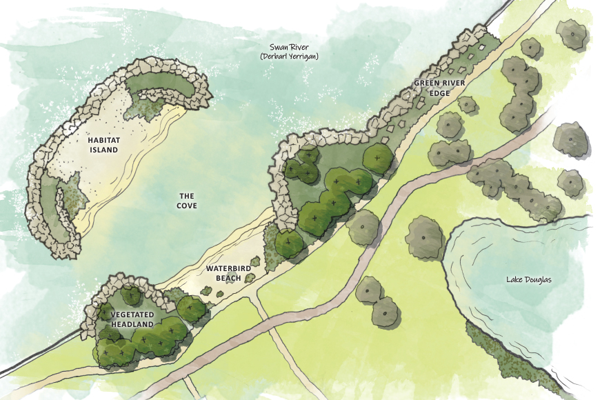
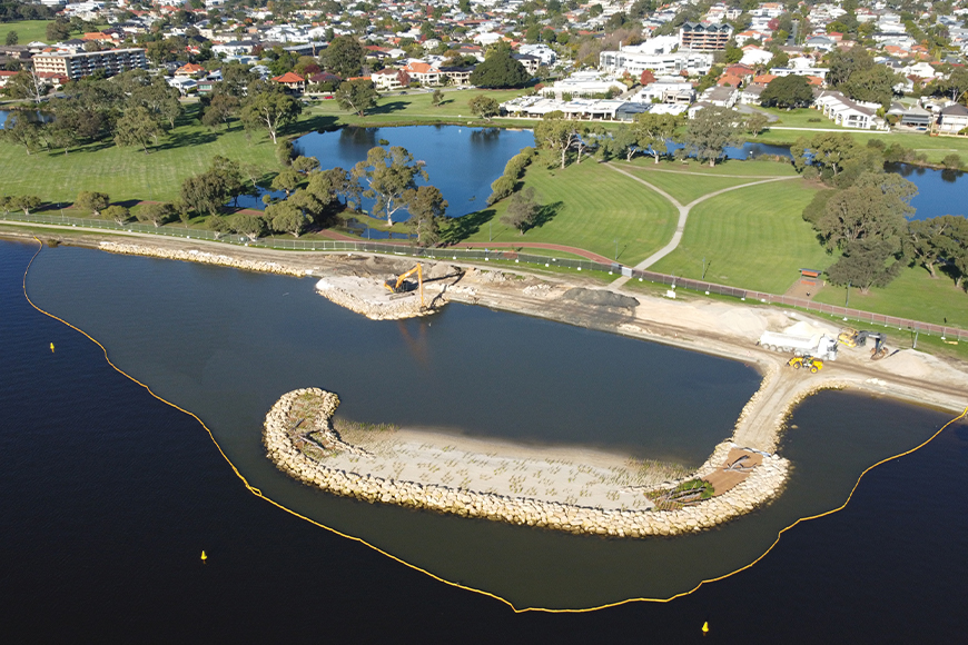
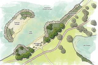
The Black Swan Habitat consists of an island, two vegetated headlands, a beach and a planted rock revetment.
The project is one of the actions of the City’s South Perth Foreshore Strategy and Management Plan (SPF Plan) which identifies Node 7: The Lakes as an area to be developed as a water-based, ecologically focused precinct, restored, expanded and integrated into its surroundings. The SPF Plan also identifies the area as a location to be developed for bird breeding.
The Black Swan Habitat provides improved habitat for native waterbirds while providing a retreat for bird watching, breeding, ecology, and learning.
The City grew approximately 11,000 native plants, and 20 trees in its nursery for the project. The new trees have replaced the introduced Casuarina cunninghamiana that had self-seeded in the area.
The City is working with community group Friends of the South Perth Wetlands to assist in environmental monitoring of the area.
The City successfully secured $700,000 in funding from the Parks and Wildlife Service at the Department of Biodiversity, Conservation and Attractions to support the $1.5 million project.
A official opening ceremony was held on Thursday 30 September 2021 and the Whadjuk Noongar name of the habitat island was announced. The river is a sacred place for Noongar people and with respect to the traditional custodians of this land, the Black Swan Habitat island has been named Djirda Miya, meaning ‘home of the birds’.
Vision
The project aims to improve habitat for native waterbirds and protect the riverbank from erosion.
Habitat has been improved by providing:
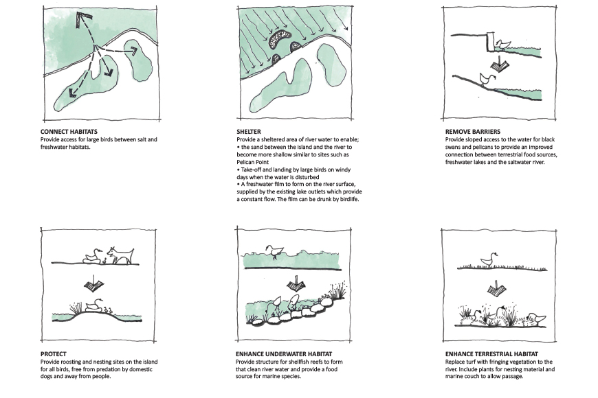
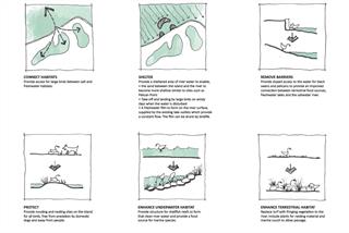
- sloped access to the water for waterbirds including black swans and pelicans to provide an improved connection between terrestrial food sources, freshwater lakes, and the salt water river
- sloping beaches on the foreshore and the island for foraging birds
- roosting and nesting sites on the island for birds, free from predation by domestic dogs
- a sheltered area of river water to enable;
- shallow water between the island and the bank to cater for a wide variety of flora and fauna including the threatened fairy tern
- take-off and landing by large birds on windy days when the water is disturbed
- a freshwater film to form on the river surface, supplied by the existing lake outlets which provide a constant flow. The film can be drunk by birdlife
- seagrass to grow on the riverbed to supply a food source for birds and aquatic species
- fringing vegetation to the river
- vegetation and logs to form windbreaks for native animals and plants and to provide roosting and perching sites for waterbirds
- structure for shellfish reefs to form that clean river water and provide a food source for marine species.
The project protects the riverbank from erosion by providing:
- a robust edge to the river that accommodates sea level rise and storm surges
- a treatment that requires minimal maintenance
- protection of the recreational land behind the edge treatment
- protection to the freshwater lakes by preventing spill-over of saline water.
